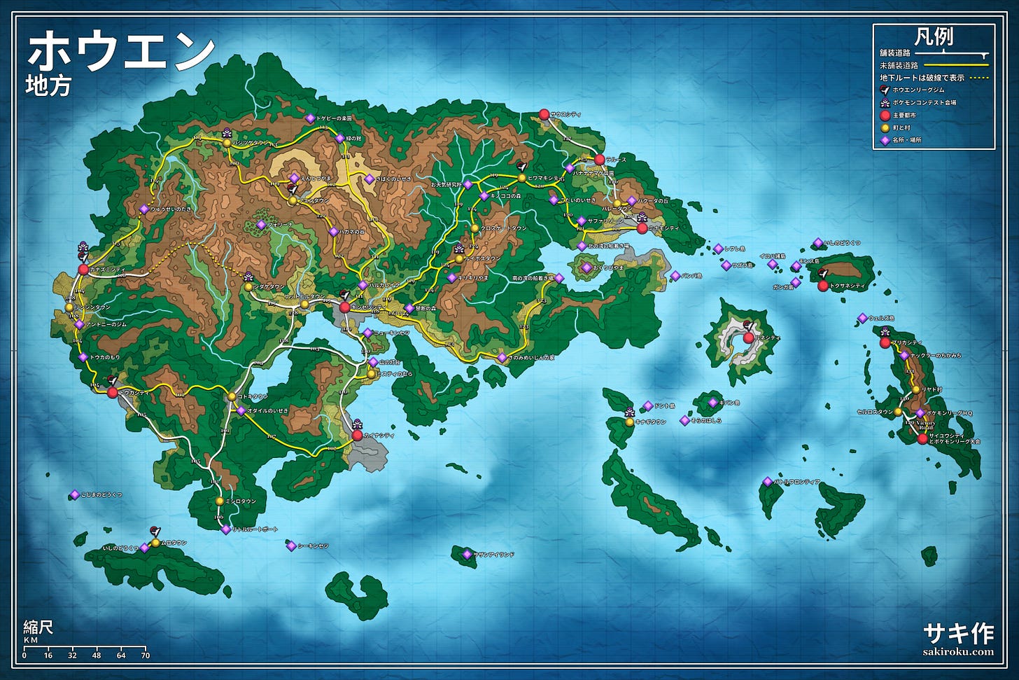
Hoenn Region Map — Pokémon Cartography Project
Also available in 日本語
Hoenn is quite possibly my favorite region. Always has been. I didn’t get around to playing the games until OR/AS was released, but something about the Advanced Generation series tickled my brain. So I find myself thinking about it a lot. And so, as I often am, I was driven to create.

This is a complete full-color geological & route map1 of the Hoenn Region, from Pokémon Ruby/Sapphire/Emerald. It’s an exhaustively-researched map covering everything from Mauville to Petalburg … and it also covers every single anime-exclusive location notable enough to have its own Bulbapedia listing, placed according to its most likely location based on the timing of its appearance in the show.
I also labeled the location of every gym & every contest — the intention was to use this map for tabletop games such as Pokérole, Pokémon Tabletop United, the D&D 5e conversions, or other TTRPGs, and knowing the canonical location of every major event struck me as a useful feature.
And finally, I translated it to Japanese, for fun.
Download
I packed it up into a neat little archive for you & threw it up on MEGA. It comes with three edits, translated to both English & Japanese/日本語:
A version with everything
A version with just the games’ canonical locations & routes
A version stripped down to just the terrain map
It’s rendered at 140ppi, so it’s a fairly good size for a home print or for usage in virtual tabletop software (if you’re running a role-playing game).
Why do this, anyways?
Most fan-drawn Pokémon maps have a set of problems with them.
The first is that they stick rigidly to the games’ depiction, to an extremely literal level. This is an odd trend that’s consistent with JRPGs generally, and Japanese culture more broadly; doing things “right” is taken to meant doing things “exactly as they were”. Therefore, copy every fence in Pallet Town and every fence on Route 132.

The second, probably in part downstream from this, is that they are only interested in the games’ content. This is kinda understandable. Much of the anime was nonsensical filler, and the movies’ directors had an agreement to never let their stories influence the rest of the franchise. I have yet to see another artist who thought of marking LaRousse City (M07) on their map.
But if you wanted a holistic assessment of any given region in the series, I feel it would be wise to consider that all of these contradictory components ought to be taken as individually flawed while determining its true character. Each depiction of this world is constrained by the nature of the medium used to convey it. That ridiculous fence setup on Route 13 is because it’s a game. Taking it literally is to be blind to the medium & its role in shaping the depiction. Matters such as the oceanic routes or the road-blockers (sleeping Snorlax, rows of dancers, little trees) used to shape player movement can’t be handled as if they were literal truth.
If one wanted to depict the Hoenn Region as being a real place, what would that look like?
Well, I gave it a shot.
Since the oceanic routes aren’t depicted on these maps (good luck drawing highway-style routes on a real ocean…), I reused the numbers for the non-canon routes connecting the anime locations to the game locations & routes. The game-only maps are unaffected.
And I’ll give the creators of things such as Minecraft recreations of Kanto some slack; if they took great creative liberties in their depictions, the nature of their medium is that what they were creating would get lost in the noise. The series doesn’t contain a lot of geographical, architectural, or other symbolic/structural cues that could allow a viewer to identify a heavily stylized depiction of, say, Lavender Town. (In fact, I’d note that the Pokémon anime in particular is notorious for using cheap, generic depictions of most of its locations.)


Finally someone said it! I've never understood why things are always taken so literal to the extreme when considering how to translate from one media to how it might be if it were actually real. Thank you!